THEY SHRANK AFRICA MAP, LOOTED THE CONTINENT DEVASTATED IT’S PEOPLE AND NOW…
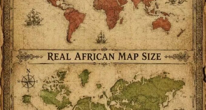
THEY SHRANK AFRICA MAP, LOOTED THE CONTINENT DEVASTATED IT’S PEOPLE AND NOW… IS THE UN VOTE THIS WEEK THE BEGINNING OF JUSTICE?
“They did not just steal your gold, your people, your gods, your medicines, and your history. They stole the very paper they used to prove they owned you. The map was the original crime. Everything else was committed inside it.”
This week, something happened at the United Nations that most of the world’s media treated as a cartography story. It was not a cartography story. The UN General Assembly voted on Friday to adopt a new world map, known as the Equal Earth projection, that makes the African continent significantly bigger while shrinking North America and Europe. The resolution was supported by 164 countries, with the United States voting against it and six others abstaining. That vote is not about the aesthetics of a diagram. It is the formal global acknowledgment of something Africa has known for five hundred years: the most widely used map in human history was a lie, it was always a lie, and the people who built the lie built everything else they did to Africa inside it.
The Map That Shrank a Continent Before Colonialism Could Divide It
In 1569, a Flemish cartographer named Gerardus Mercator created a map projection designed for one specific purpose: to help European sailors navigate across oceans by allowing them to draw a straight line between two points without adjusting their compasses. That projection shows Greenland as nearly the same size as Africa, when in reality Africa is about fourteen times larger. That is not a minor technical miscalculation. That is a civilisational lie embedded into every classroom, every textbook, every government building, every media broadcast, and every policy document that used a world map for the past four and a half centuries.
Far from being innocent or objective sketches of geography, maps have always been political instruments, shaping how people see the world and their place in it. The Mercator projection did its political work with extraordinary efficiency. It bloated Europe while crushing Africa into irrelevance. And three hundred years after Mercator drew his navigation tool, the same powers that made Africa look small on paper gathered in Berlin to make it small in practice. The Berlin Conference of 1884 to 1885, when major European powers met to carve up Africa, is the most striking example of maps being used to expand and satisfy imperial ambition. They had already shrunken Africa on paper. Berlin was simply the meeting where they agreed on which European hand would hold which shrunken piece.
The Mercator projection distorted Africa’s identity and reshaped how the world perceived the Global South. A continent that contains thirty countries including the United States, India, Japan, China, and most of Europe within its actual borders was made to look marginal, peripheral, and small in the geographic imagination of every generation that grew up with that map on their classroom wall. That visual marginalisation was not accidental. It was the cartographic foundation on which every subsequent form of colonial extraction was built. You do not feel guilty stealing from somewhere that barely appears on the map.
What They Stole Before They Stole the Map’s Correction
The map was the frame. Inside the frame they built the greatest systematic theft in human history and they built it across five overlapping categories of extraction that each deserve to be named precisely.
They stole bodies. The transatlantic slave trade moved an estimated twelve to fifteen million African people across the Atlantic between 1500 and 1900, with mortality rates on the Middle Passage that mean the actual number taken from African communities was substantially higher. Each enslaved person represented not just a human life but a generation of knowledge, a lineage of skill, a family network of accumulated cultural intelligence that the slave ship removed from Africa permanently. The Yoruba spiritual knowledge that the Candomblé preserved in Brazil, the Igbo republican governance memory that survived in Caribbean community organisation, the Bantu agricultural knowledge that Caribbean enslaved communities applied to plantation survival, all of it was African civilisational capital that Europe extracted in human form and put to work building the wealth that funded the industrial revolution.
They stole objects. The Benin Bronzes, perhaps the most documented case of cultural artifact theft in history, were seized by a British punitive expedition in 1897 and distributed across European museums where most of them remain today. The Benin bronzes are not museum objects that happen to be African. They are royal ancestral altars, ritual objects, court documentation systems, and historical records whose removal from Benin was the equivalent of burning the National Archives. The British did not take them as art. They took them as loot from a military operation whose explicit purpose was the destruction of the Benin Kingdom’s political and cultural sovereignty. As Roth documented in his 1903 account of the kingdom, the bronzes represented centuries of accumulated civilisational achievement. Their removal was not collecting. It was erasure with better lighting.
They stole medicines. The pharmacological knowledge systems of West Africa, the specific plant-medicine traditions that practitioners across Yorubaland, Igboland, the Niger Delta, and the savannah belt had developed through thousands of years of systematic empirical observation, were extracted by colonial botanical expeditions, classified in European scientific frameworks that stripped the indigenous knowledge context, and incorporated into pharmaceutical development programs that patented their derivatives without acknowledgment or compensation. The rubber plant whose extraction economics drove the Belgian Congo’s genocide was an African plant. The quinine that made European soldiers survive in the tropics came from indigenous knowledge of bark preparation. The colonial enterprise did not bring medicine to Africa. It found medicine in Africa, renamed it, and sold it back.
They stole cosmologies. The systematic missionary destruction of African spiritual knowledge systems was not an incidental byproduct of Christian evangelism. It was a deliberate programme of cognitive colonisation that understood, correctly, that a people who retained their spiritual knowledge framework retained the intellectual architecture through which they could resist colonial domination. As Lucas documented in his 1948 study of Yoruba religion and as Idowu confirmed in his 1962 theological study, the Yoruba spiritual system was not animistic superstition. It was a sophisticated cosmological philosophy with a detailed model of the universe’s operating structure. The missionaries who burned Ifa boards and renamed Orishas as demons were not saving souls. They were destroying the operating manual of a civilisation.
They stole the Ofe. This is not a metaphor. The transmission chains of the most advanced Yoruba, Igbo, Benin, and Igala knowledge systems, including specifically the training sequences that produced the capability the Yoruba called Ofe, were destroyed by the combination of nineteen century wars, missionary education, and colonial law that the earlier article in this series documented in detail. The knowledge that those chains carried was not supernatural. It was the advanced curriculum of a sophisticated engagement with physical reality that five separate Nigerian peoples had developed independently across thousands of years. Its destruction was the intellectual equivalent of burning every university on the continent. Which, effectively, is what the colonial disruption of African knowledge transmission systems accomplished.
The Vote and Why America Said No
The 193-member UN General Assembly overwhelmingly adopted the resolution titled “Correct the map: rebalancing global cartographic representation and promoting equitable representation of the world’s regions, particularly Africa,” receiving 164 votes in favour, with a lone vote against from the United States.
The United States voting against a resolution to correct a five-hundred-year-old cartographic distortion that made Africa look small is not a diplomatic technicality. It is a statement. The country that inherited the greatest economic benefit from African slavery, that built its agricultural, industrial, and financial foundations on the extracted labour of enslaved African people, voted against the symbolic correction of the map that made all of that extraction seem geographically and therefore morally reasonable. The geography of smallness and the economics of extraction are the same project. Voting to preserve the one is voting to deny the other.
France, which co-sponsored the resolution, announced it would abandon the Mercator projection, with its Foreign Minister stating that correcting a distorted representation is already an act of truth. That France, whose own colonial record in Africa is among the most comprehensively brutal in the historical register, including the rubber quotas of Congo, the forced labour systems of Francophone West Africa, and the ongoing Françafrique financial extraction that continues to drain former colonies through currency manipulation and sweetheart contracts, would co-sponsor this resolution tells you something about how low the bar for symbolic justice has fallen. France did not end its extraction of Africa. It voted for a more accurate map while the extraction continued. The map changed. The CFA Franc did not.
The Togo Moment and What It Means
The resolution was spearheaded by Togo, whose Foreign Minister Robert Dussey said maps guide education, nourish the imagination, and influence collective perceptions, and are therefore never neutral. Togo is a country whose borders were drawn by the same Berlin Conference that the Mercator map made possible. A country with a straight-line western border that cuts through Ewe communities who have never stopped being one people regardless of which passport their colonial boundary required them to carry. Togo leading the campaign to correct the map is historically precise in a way that none of the UN speeches acknowledged. The people whose territory was arbitrarily defined by the same map that distorted their continent’s size are the ones who called for the correction. Justice has a geography too.
The Mercator map shrank Africa. The Berlin Conference divided Africa. The Equal Earth projection restores Africa. But only Africans can liberate Africa. That sentence is correct in its structure but incomplete in its implication. Correcting the map is not liberation. It is the correction of a symbol. Liberation is the repatriation of the Benin Bronzes, and the Ife artifacts, and the Nok terracottas, and the thousands of objects that sit in European museums whose acquisition documents, where they exist at all, describe military seizure as cultural preservation. Liberation is the dissolution of the CFA Franc system that requires fourteen African nations to deposit sixty percent of their foreign reserves in the French treasury as the price of monetary stability. Liberation is the cancellation of the debt structures that extract more capital annually from African governments than those governments receive in all forms of development assistance combined. Liberation is the formal acknowledgment by former slave-trading and colonising powers that what they did was not a historical phase that Africans should move past, but an ongoing structural robbery whose current benefits require current restitution.
The map was always the smallest of the thefts. What was stolen inside the map, the bodies, the bronzes, the medicines, the cosmologies, the knowledge systems, the political architectures, the spiritual technologies, the accumulated civilisational capital of the oldest human civilisation on earth, is what the resolution about the map cannot address and what no cartographic correction, however accurate, can restore.
Correct the map. Then correct the history. Then correct the economics. Then correct the silence about what was taken and has never been returned.
Then, and only then, does the map correction mean what the 164 countries that voted for it deserve to have it mean.
Ire ooo
Alex Sewo
References
1. Davidson, Basil. The African Slave Trade: Pre-Colonial History 1450 to 1850. Atlantic Little Brown, Boston, 1961.
2. Rodney, Walter. How Europe Underdeveloped Africa. Bogle L’Ouverture Publications, London, 1972.
3. Roth, H. Ling. Great Benin: Its Customs, Art and Horrors. F. King and Sons, Halifax, 1903.
4. Lucas, J. Olumide. The Religion of the Yorubas. C.M.S. Bookshops, Lagos, 1948.
5. Idowu, E. Bolaji. Olodumare: God in Yoruba Belief. Longmans, London, 1962.
6. Harley, J.B. The New Nature of Maps: Essays in the History of Cartography. Johns Hopkins University Press, Baltimore, 2001.
7. Achebe, Chinua. The Trouble with Nigeria. Fourth Dimension Publishing, Enugu, 1983.
8. Ake, Claude. Democracy and Development in Africa. Brookings Institution Press, Washington D.C., 1996.
9. Falola, Toyin. Nationalism and African Intellectuals. University of Rochester Press, Rochester, 2001.